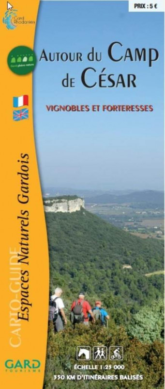
"Around Caesar's Camp
Presentation
Around Bagnols-sur-Cèze, in the heart of the Gard Rhodanien region, bordered by the Rhône and crossed by the Cèze and Tave rivers, this region boasts a wealth of assets that contribute to the richness of its hiking offer.
More than 350 km of trails lead to Roman oppida, castles, hilltop villages, rocky peaks, limestone plateaus, garrigues, forests and vineyards.
So many exceptional sites shaped by history, offering walks through the Gallo-Roman site of Caesar's camp, medieval castles, shady, intimate village lanes, lavoirs, fountains, chapels, mills and architectural treasures that have stood the test of time.
This simplified cartoguide features a network of over 350 km of hiking trails, most of which are accessible on foot, horseback or mountain bike. You can choose to follow one of the suggested trails, or put together your own;
Hundreds of possible combinations! This book also includes: interpretation trails, suggestions for itinerant hikes...
Tarifs
| Fares | Min | Max |
|---|---|---|
| 01/01/2021 - 31/12/2026 | ||
| Adult | 5.00€ | |
Adult: 5 €.
FICHE_INFO_SIMPLE_LIBELLE_DESTINATION
"Autour du Camp de César"
Espace Saint Gilles
Avenue Léon Blum
30200
Bagnols-sur-Cèze
GPS coordinates
Latitude : 44.162337
Longitude : 4.617567
Contact
"Around Caesar's Camp
Espace Saint Gilles
Avenue Léon Blum
30200
Bagnols-sur-Cèze


